Map of Africa Mountain Raises Tourism Prospects
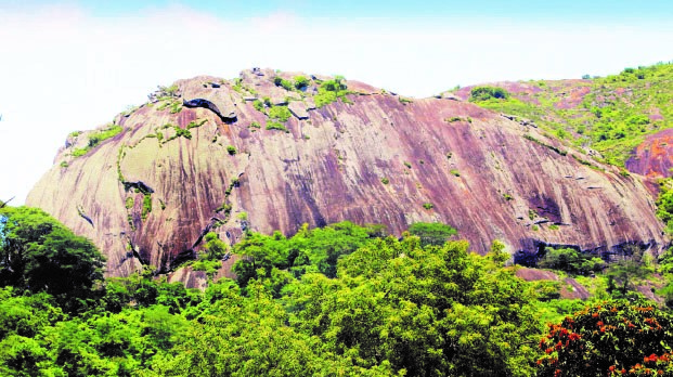 The unique Mware Mountain in Nyakunhuwa, Zaka, which depicts the map of Africa is being considered by Government to be designated as a national monument.
George Maponga-Masvingo Bureau
It is not an optical illusion. Neither is it a script for an African movie. The sacred Mware Mountain in the Veza area under Chief Nyakunhuwa in Zaka, Masvingo, has attracted the attention of the Government which is now exploring the possibility of designating it a national monument mainly because of the map of Africa that is clearly depicted on the side of this superimposing peak. Mware has stunned local inhabitants, who are predominantly of the Nyakunhuwa clan of the Shumba (The Lion) totem, by the unique spectacle of a drawing of the map of Africa on one side of the mountain and attributed this to God’s grandeur and named the outstanding peak after the creator of the universe. Besides the incarnation of Africa’s map on Mware, atop the sacred peak is a deck of water that never runs dry and is believed to be the harbinger of life as traditional rainmaking binges and other rituals to appease the spirits are held. To complete the triad of wonders at Mware is a deep cave known as ninga in Shona where inhabitants of the area used to seek refuge in times of conflict during the precolonial era. Government has now set its sights on designating this unique mountain in the Zaka rural heartland into a national monument or tourist attraction centre as part of a drive to boost domestic tourism in line with the Second Republic’s mantra of leaving no one and no place behind. ReadMore